Mount Catherine: Egypt’s Highest Peak & Hiking Adventure
Standing at about 2,642 meters (some sources range from 2,629 to 2,646 meters), Mount Catherine holds the title of Egypt’s highest peak. Sitting within the rugged terrain of the South Sinai region in the vicinity of the town of Saint Catherine, this towering mountain is both a sight of beauty, full of history and a spiritual heritage linking it to Saint Catherine Monastery. Be it inviting hikes, magnificent sunrises, or cultural enrichment; Mount Catherine is the place that will offer you a remarkable experience of natural beauty harmonized with the ancient importance.
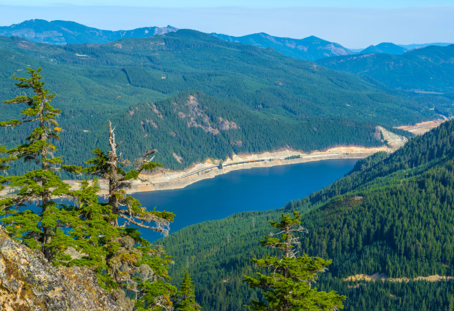
Explore Mount Catherine in depth
Overview of Mount Catherine Egypt
Mount Catherine Egypt, the nation’s highest peak, offers stunning views, rich history, and a unique blend of adventure and spirituality.
Location
The mountain of Mount Catherine is situated in the South Sinai governorate region of Egypt near the town of Saint Catherine. It is also situated in the midst of the rugged Sinai Peninsula, one of the most picturesque areas in the world with its mountainous landscapes and desert scenes.
The mountain falls within the Saint Katherine Protectorate in a protected region preserving rare plants and animals and cultural heritage. This is also the gateway to the Sinai Mountains which is where a few other prominent mountains reside. The combination of its remote yet accessible location makes it a favored base camp for trekking, nature observation and sightseeing of nearby historic and religious places.
Why to visit
The trip to Mount Catherine in Egypt is a pleasant combination of sport exercise and spiritual experience. Being the highest point in the country with a height of 2,642 meters above sea level, mount Catherine is one of a kind that hikes have their eyes set on due to its mountainous scenic beauty, and historical legend.
It starts in the serene little town of Saint Catherine and passes through the ancient paths with spectacular rocks until breathtaking views of the Sinai and the Red Sea. The trek is physically challenging, but spiritually rewarding; few will forget it and it is a perfect place to visit when one wants to get a combination of natural beauty as well as a virtually living sense of traditions.
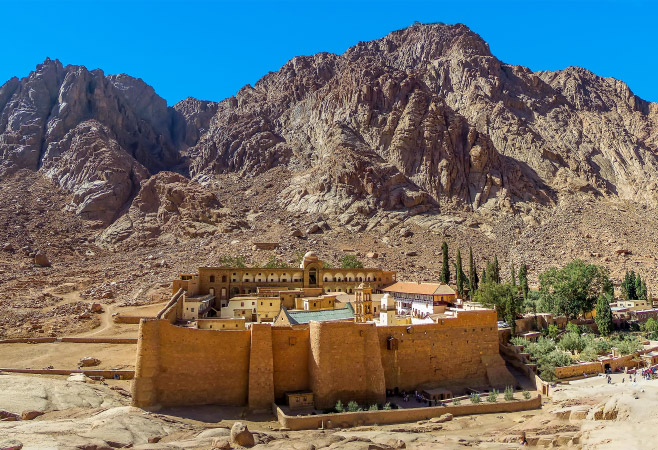
Reason to visit mount Catherine
Basic facts
Mount Catherine is Egypt’s highest mountain and a remarkable destination for adventure, history, and nature lovers. Below are the key facts you should know before planning your visit:
- Highest peak in Egypt: 2,642 meters (8,668 feet)
- Location: Near the town of Saint Catherine, South Sinai Governorate
- Protected area: Part of the Saint Katherine Protectorate
- Cultural & Spiritual significance: Named after Saint Catherine of Alexandria
- Summit installations: Chapel and meteorological station at the top
- Popular hiking route: Shaq Mousa trail, estimated at 6–10 km one way depending on the chosen path, with a total round-trip distance of roughly 20 km.
Review of map
Plan your way around Mount Catherine by following the Sinai Hikes map and other best resources to ensure your trip is not wasted:
- Trail description: The trail usually starts near Saint Catherine town and climbs between 1,070 and 1,450 meters in elevation gain, depending on the route.
- Markers and aspects: Aspects such as a starting altitude (~1,570 m) of the road, switchback trails, sensational rock structures and peak features such as the chapel and weather station are noteworthy.
- Topographic knowledge: Contours show the steep climbs, zigzagging paths and location just south of Mount Sinai to provide the necessary directions and time.
- Hiker utility: This map will increase route awareness, allow visual inspection of elevation profiles and provide safer planning of trips across the desert.
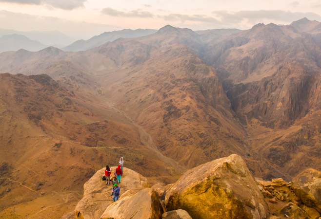
Map of mount Catherine
If you’d like to discover more of Egypt’s dramatic landscapes beyond Mount Catherine, explore the vast and rugged beauty of the Eastern desert Egypt.
Hiking route overview
Mount Catherine presents an unforgettable hiking experience as one of the most challenging routes in the country of Egypt, which is composed of mountains, spiritual history, and beautiful sights of the desert.
- Launching pad: Most treks start from the town of Saint Catherine, often via Wadi Arbaeen or Wadi Shaq Mousa, following historic Bedouin pathways.
- Path and distance: Hikers climb a 10.5 km Shaq Mousa trail that zigzags the rocks along its route before the last push to the top- total distance is approximately 20km when the descent is added.
- Elevation chart: The trail begins at about 1,570 m in Saint Catherine town and ascends to its high point of 2,642 m at an altitude elevation of almost 1,070 m. The ascent usually takes about 5–6 hours, with a similar time needed for the descent, making it a full-day hike.
- Highlights and terrain: The trip is characterized by an ever-evolving landscape--old rock formations, sweeping Sinai panoramas. The mountain top offers the hikers with clear mountain silence and panoramas above the clouds.
- Controlled experience: Most hikers prefer to have an experience with experienced Bedouin tour guides that assist in the process of navigation, security, and provide local tales and natural folklore.
What to expect
Discover the wonders that await you at Egypt's highest peak:
- Amazing summit sceneries: It is expected to have extremely stunning panoramas that peep at the highlands of Sinai, at Sinai valleys and at the Red Sea- a vista unmatched in other parts of Egypt.
- Various sceneries: The trail follows harsh, hilly routes, with the zig-zag Shaq Mousa track. There will be great rock formations, high steep climbs, and diverse topography.
- Summit characteristics: On the top, there is a small chapel and meteorological station that form a nice and tiny reward of the climb.
- Spiritual and cultural vibes: The mountain is steeped in legend as it is named after Saint Catherine the spiritual top of the physical mountain.
- Difficult hiking experience: The hike covers an approximate distance of about 10.5 km one way with an altitude gain of almost 1,070 m starting off in Saint Catherine town. Plan on an all-day outing in variable weather with a large amount of elevation gain.
- Local guidance: The majority of hikers use the guidance of experienced Bedouin guides to navigate, ensure their security and gain cultural insights, which has improved their safety and enriched their cultural experience.
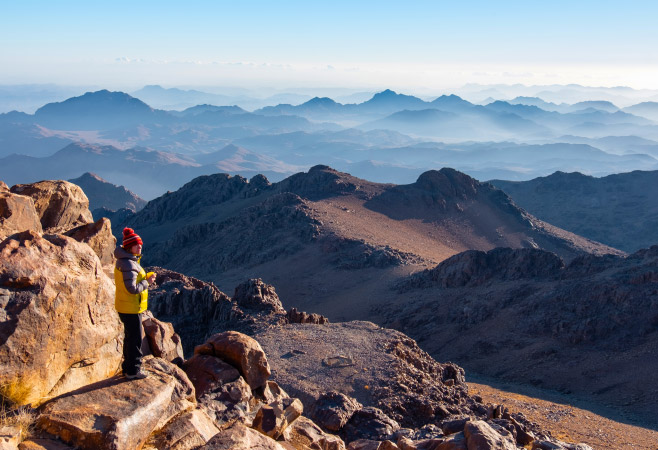
Discover what awaits you at Egypt’s highest peak
For another impressive mountain challenge in Egypt, you can also read about Gabal Sha Ib El Banat, a peak known for its rugged terrain and striking scenery.
Tip to travel mount Saint Catherine
Discover essential tips to make your journey to Mount Saint Catherine (Mount Catherine Egypt) safe, smooth, and memorable:
- Reserve a local guide: You should book a trusted Bedouin guide. It is usually obligatory and it adds safety, culture and orientation to your journey.
- Register your hike: Local registration (usually the task of your guide/trekking operator) may be required, as a precautionary measure in the event of a rescue.
- Layering: Temperatures change between scorching desert sun to chilly mountain air-wear items that breathe, use lightweight merino as a base layer, a warmer fleece and a windproof shell.
- Hiking gear: Particularly in the backcountry: A good pair of hiking boots, plenty of water and high-energy food; a head lamp in case you leave early in the morning or have experienced an early sunset; some sun protection (sunhat, sunblock) and a little first-aid kit.
- Plan for an all-day hike: The hike would be demanding, 10–11 km one way, 5–6 hours up and the same to go down. Come early in the morning to see the sun.
- Hydration and food: Always have enough water and food that is enough in energy content-there may often be limited options on the road.
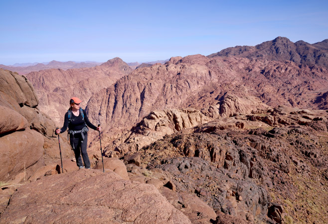
Mount Saint Catherine travel advice
Hikers exploring Mount Catherine’s rugged beauty may also find inspiration in the ancient paths of Serbal Mountain.
FAQs about mount Saint Catherine
Here are some common questions and clear answers to help you prepare for your visit to Mount Saint Catherine in Egypt.
What is the Mount Catherine hiking route like to the summit?
The hiking trail to the peak of Mount Catherine is the picturesque Shaq Mousa trail which can cover 10-11km in one direction. It starts at the town of Saint Catherine and ascends approximately 1,070 meters using zigzagging and steep routes over rocks and lovely mountain vistas until it tops out at Egypt's highest peak 2,642 meters.
Are guides required for the hike to Mount Catherine?
Yes, hiring a guide for the hike to Mount Catherine is highly recommended and often required. Local Bedouin guides handle route navigation, register your trek with authorities, and share cultural and historical insights. Their expertise ensures safety, enhances the experience, and supports the local community in Saint Catherine.
Is Mount Catherine safe for solo hikers?
Mount Catherine is not regarded as being suitable to hike as a single hiker because it is remote, steep and weather is unpredictable. Local knowledge is essential for navigation. It is also highly recommended to go hiking with a qualified Bedouin guide, and the guides are the people who know how to practise safety, manage the route, and follow local laws.
While exploring the Sinai mountain range, you might also be interested in discovering Gabal Sha'ib El Banat, another remarkable peak known for its unique landscape and cultural significance.
In conclusion
Mount Catherine proudly remains to be the highest mountain in Egypt, which features a unique combination between its spectacular landscape, rugged adventure, and rich traditions. With hiking trails with rocky conditions and the incredible views at the top it is a place that should not be missed when one plans an itinerary in Egypt. Apply for your Egypt eVisa via the official portal before you make the plan to travel to Egypt and enter the country with no difficulties. When you have prepared all your travel documents, you could concentrate on the unrivalled beauty and spiritual importance characterising Mount Catherine as a memorable landmark.
Related Articles
- Blue Hole in Dahab, Egypt: Dive Guide & Tips
- Queen of Egypt: History, Power, and Royal Legacy
- Temporary Residence Permit Egypt: Requirements & Process
- Egypt Family Visa: Eligibility, Documents, and Process
- Tipping in Egypt: How Much Should You Tip
- Egypt in 8 Days: Complete Travel Itinerary and Highlights
- Egypt Visa Multiple Entry: Rules, Fees & Application Guide
- Egypt Visa on Arrival: Eligibility, Cost & Application Tips


